Botlink の代替手段
6Botlink の代わりとなる 6 個の無料および有料のリストをまとめました。 主な競合相手はMaps Made Easy、 DroneDeployです。 これらに加えて、ユーザーは Botlink と Pix4Dmapper、 Skycatch、 Agisoft Metashape の間の比較も行います。 また、他の同様のオプションもここで確認できます: 写真およびグラフィックソフトウェア。
Botlink の代わりとなる 6 個の無料および有料のリストをまとめました。 主な競合相手はMaps Made Easy、 DroneDeployです。 これらに加えて、ユーザーは Botlink と Pix4Dmapper、 Skycatch、 Agisoft Metashape の間の比較も行います。 また、他の同様のオプションもここで確認できます: 写真およびグラフィックソフトウェア。
Botlink の代わりとなる 6 個の無料および有料のリストをまとめました。 主な競合相手はMaps Made Easy、 DroneDeployです。 これらに加えて、ユーザーは Botlink と Pix4Dmapper、 Skycatch、 Agisoft Metashape の間の比較も行います。 また、他の同様のオプションもここで確認できます: 写真およびグラフィックソフトウェア。
Botlink enables users to fly drones, create aerial maps, and automatically sync those maps with...
Botlink enables users to fly drones, create aerial maps, and automatically sync those maps with...

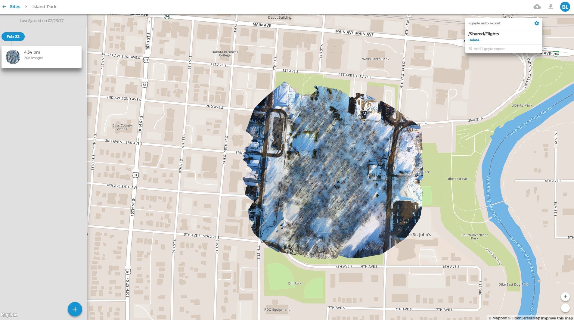

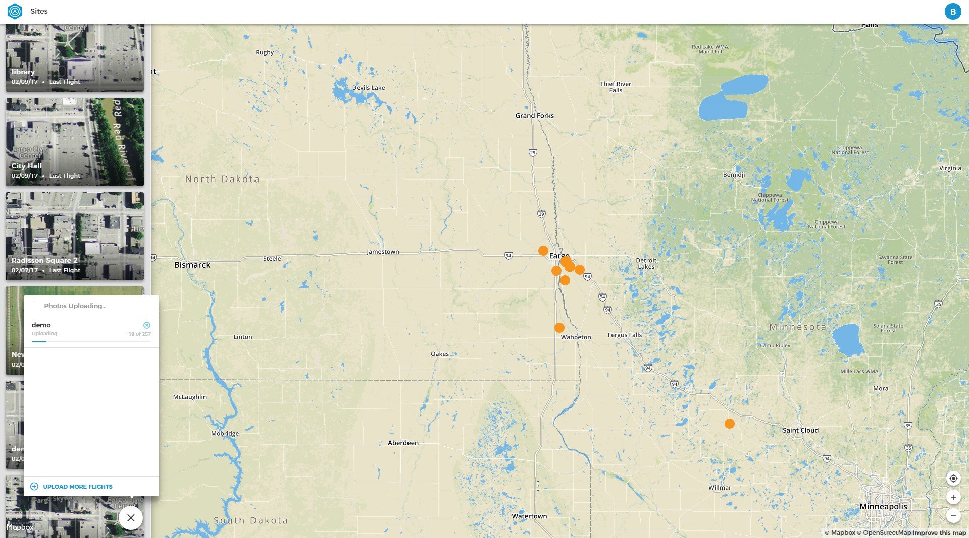
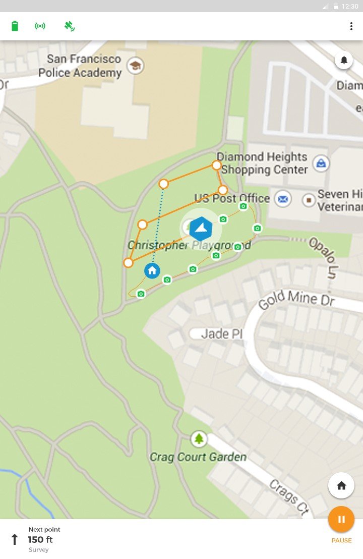

Botlink is the easiest and most reliable way to collect aerial imagery to use in construction or agriculture. Fewer buttons to push, a more intuitive flight process, and an incredibly user-friendly
aerial mapping experience mean you'll spend less time learning complex systems and more time getting actual work done. Once your aerial maps are created, Botlink automatically syncs your imagery with Procore, Egnyte, and other industry-specific software so that your drone data is available when and where you want to use it.
Supports DJI Phantom 3 Pro, Phantom 4, Phantom 4 Pro, Mavic Pro, Inspire 1 v2, Inspire 1 Pro, and Matrice 100.
ソフトウェアについての意見を共有し、レビューを残してさらに向上させるのに役立てましょう!
変更の提案
あなたのフィードバック
Your vote has been counted.
Do you have experience using this software?
