OpenJUMP GIS 대안
44개의 무료 및 유료 대안을 OpenJUMP GIS에 대한 목록으로 정리했습니다. 주요 경쟁 업체는 GRASS GIS, Azimap GIS입니다. 이 외에도 사용자들은 OpenJUMP GIS와 gvSIG Desktop, uDig 간에 비교를 하기도 합니다. 또한 여기서 다른 유사한 옵션을 살펴볼 수 있습니다: About.
4개의 무료 및 유료 대안을 OpenJUMP GIS에 대한 목록으로 정리했습니다. 주요 경쟁 업체는 GRASS GIS, Azimap GIS입니다. 이 외에도 사용자들은 OpenJUMP GIS와 gvSIG Desktop, uDig 간에 비교를 하기도 합니다. 또한 여기서 다른 유사한 옵션을 살펴볼 수 있습니다: About.
4개의 무료 및 유료 대안을 OpenJUMP GIS에 대한 목록으로 정리했습니다. 주요 경쟁 업체는 GRASS GIS, Azimap GIS입니다. 이 외에도 사용자들은 OpenJUMP GIS와 gvSIG Desktop, uDig 간에 비교를 하기도 합니다. 또한 여기서 다른 유사한 옵션을 살펴볼 수 있습니다: About.
GRASS GIS (Geographic Resources Analysis Support System)는 오픈 소스, 무료 소프트웨어 (FOSS)입니다.
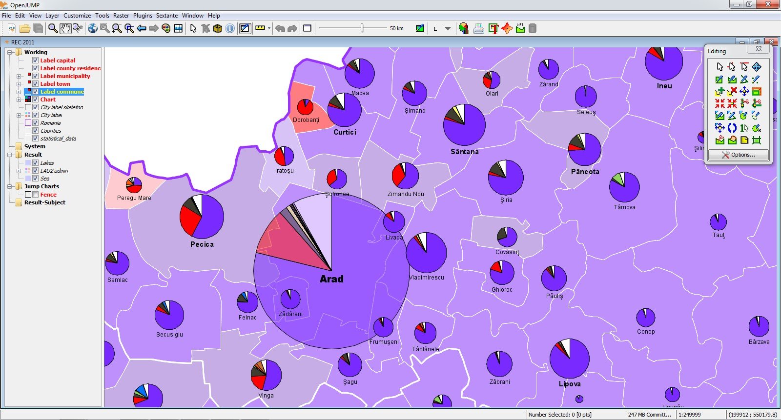
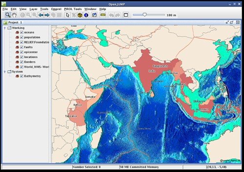
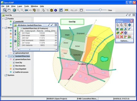
The current version can read and write shapefiles simple GML files as well as several other vector formats via plugins. It can also read from several spatial databases and write to postgis. It has support for images and for WFS and WMS web-services. So you can use it as GIS Data Viewer. However, its particular strength is the editing of geometry and attribute data. One can style the appearance of data in OpenJUMP's map display and can export the view to SVG. A growing number of vector analysis tools for topologic analysis and overlay operations is available too. OpenJUMP 1.8 adds coordinate reference system transforms and 1.9 adds several spatial databases reading capabilities as well as a lot of bug fixes and improvements.
Detailed information on OpenJUMP can be found on our Wiki ( http://ojwiki.soldin.de/index.php?title=Main_Page ).
소프트웨어에 대한 의견을 공유하고 리뷰를 남겨 더 나아지도록 도와주세요!
변경 제안
귀하의 의견
Your vote has been counted.
Do you have experience using this software?
