Google Earth is a web and desktop program that provides a 3D representation of Earth using satellite imagery, aerial photography, and GIS data. It allows users to explore cities and landscapes from various angles, offering a comprehensive view of th…
Salesforce Maps is a sales mapping tool that integrates with Salesforce CRM to help businesses visualize and analyze sales data geographically, optimize sales routes, and increase productivity through real-time insights and embedded guidance, suppor…
A desktop mapping tool for PC, Mac, and Linux, offering advanced GIS capabilities, historical imagery, and data import/export features for geographic analysis and visualization.
A comprehensive fleet management platform for industries like transportation, logistics, and construction. It offers real-time GPS tracking, ELD compliance, routing, safety tools, and automated alerts to optimize operations.
Tableau is a powerful data visualization and business intelligence tool that allows you to analyze and visualize data in an interactive and meaningful way. It enables users to connect to various data sources, create dashboards, and share insights.
Salesken is an intelligent sales automation platform designed to enhance sales processes through advanced functionalities. It includes voice call analytics, key point detection, AI-driven sales suggestions, sales skills training modules, and data vi…
SalesRabbit is a cutting-edge, all-in-one field sales management solution, designed to optimize sales processes for businesses. It offers robust lead management, team motivation tools, and resource optimization features, enabling sales teams to enha…
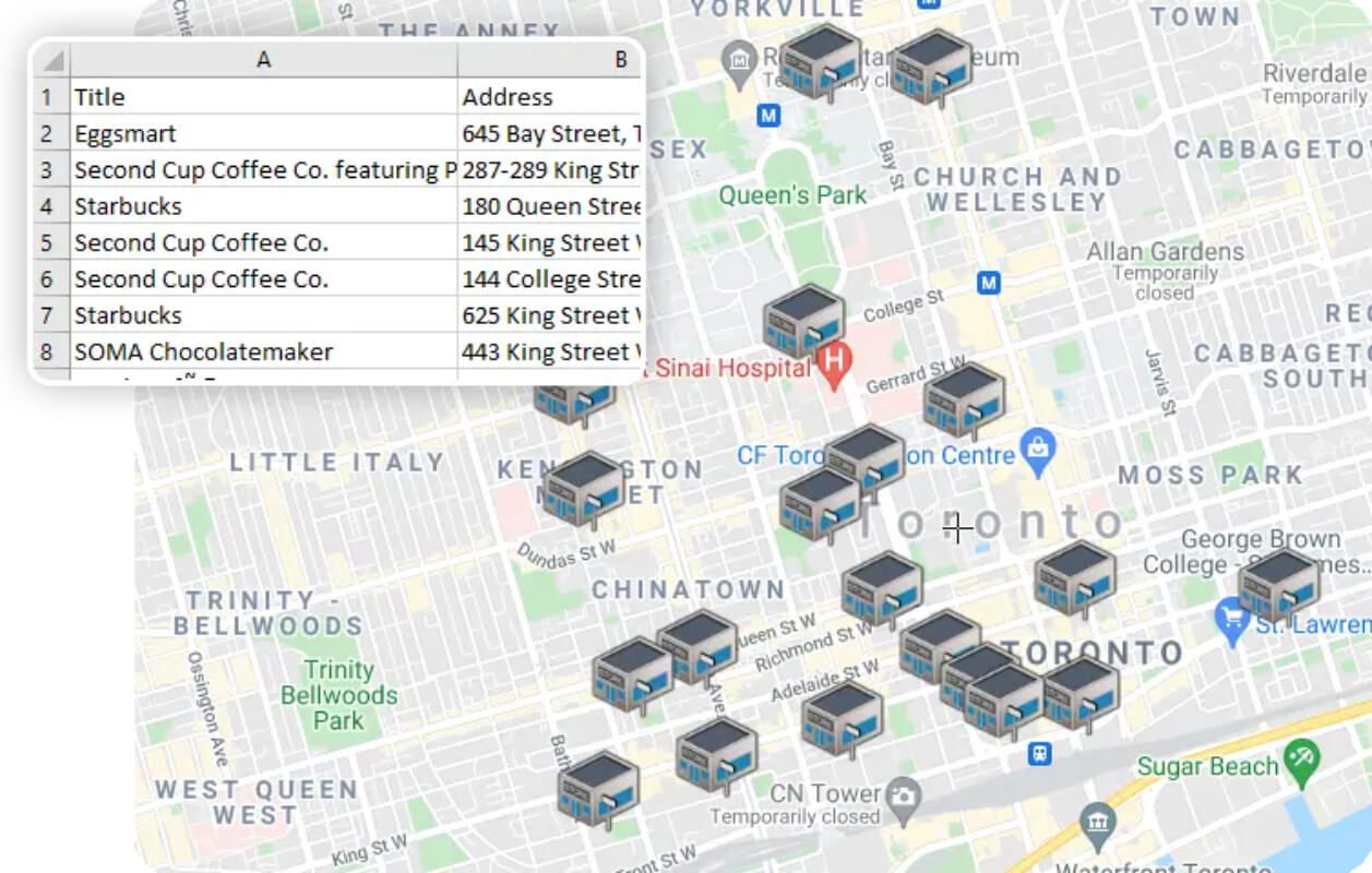
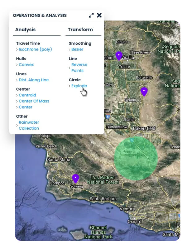
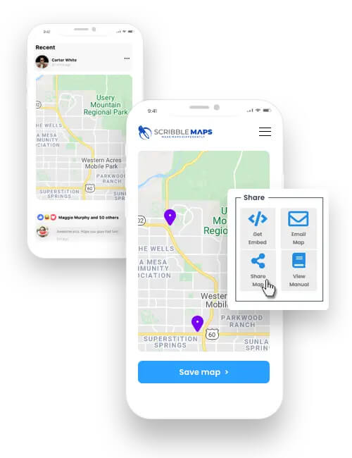
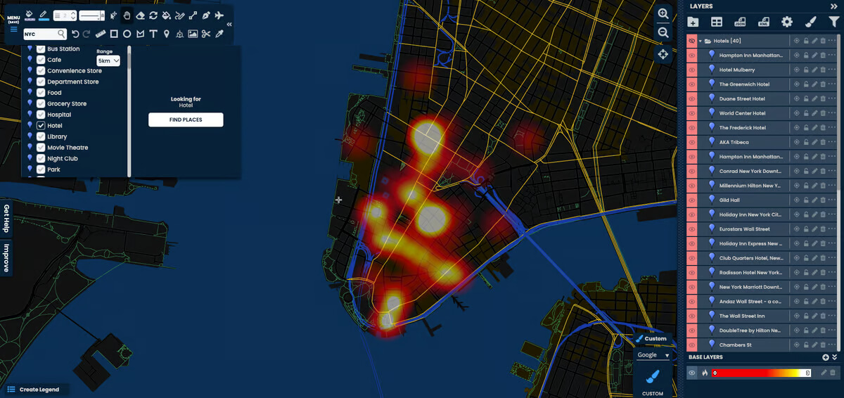
ScribbleMaps is an online GIS/mapping platform that enables users to create, analyze, and share maps effortlessly. It includes advanced drawing tools, data filters, and collaboration features, making it suitable for applications such as real estate, engineering, research, business, exploration, and construction. The platform also ensures data privacy and access control with secure, password-protected sharing and embedding options.
ScribbleMaps is an online GIS/mapping platform that enables users to create, analyze, and share maps effortlessly. It includes advanced drawing tools, data filters, and collaboration features, making it suitable for applications such as real estate, engineering, research, business, exploration, and construction. The platform also ensures data privacy and access control with secure, password-protected sharing and embedding options.
Scribble Maps Platforms
Mac
Windows
Linux
Web-Based
Scribble Maps Video and Screenshots
Scribble Maps Overview
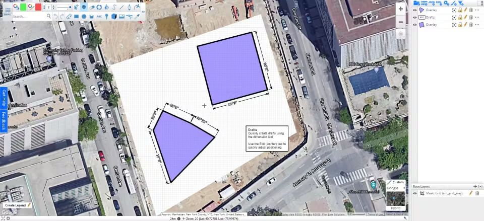
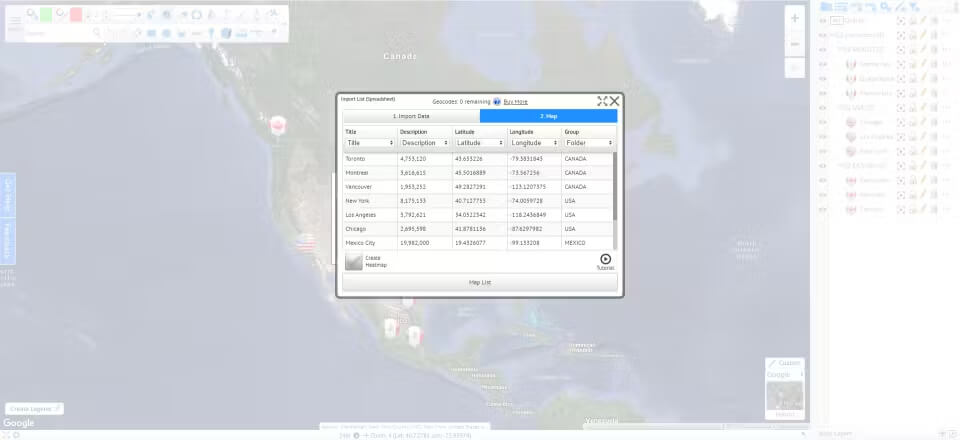
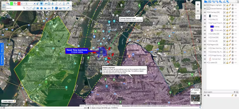
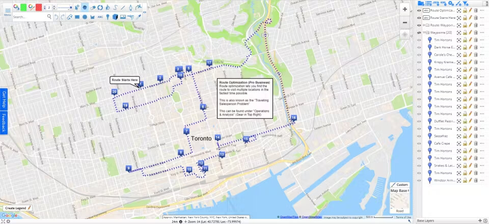
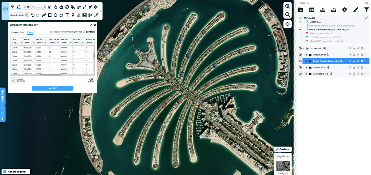
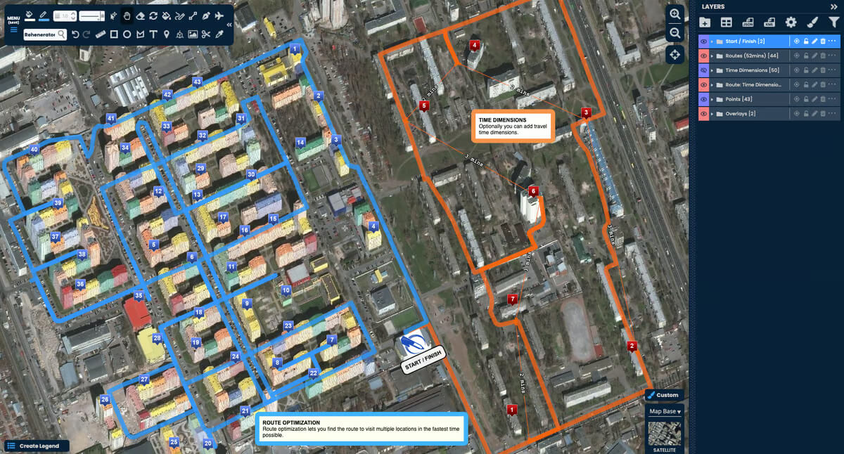
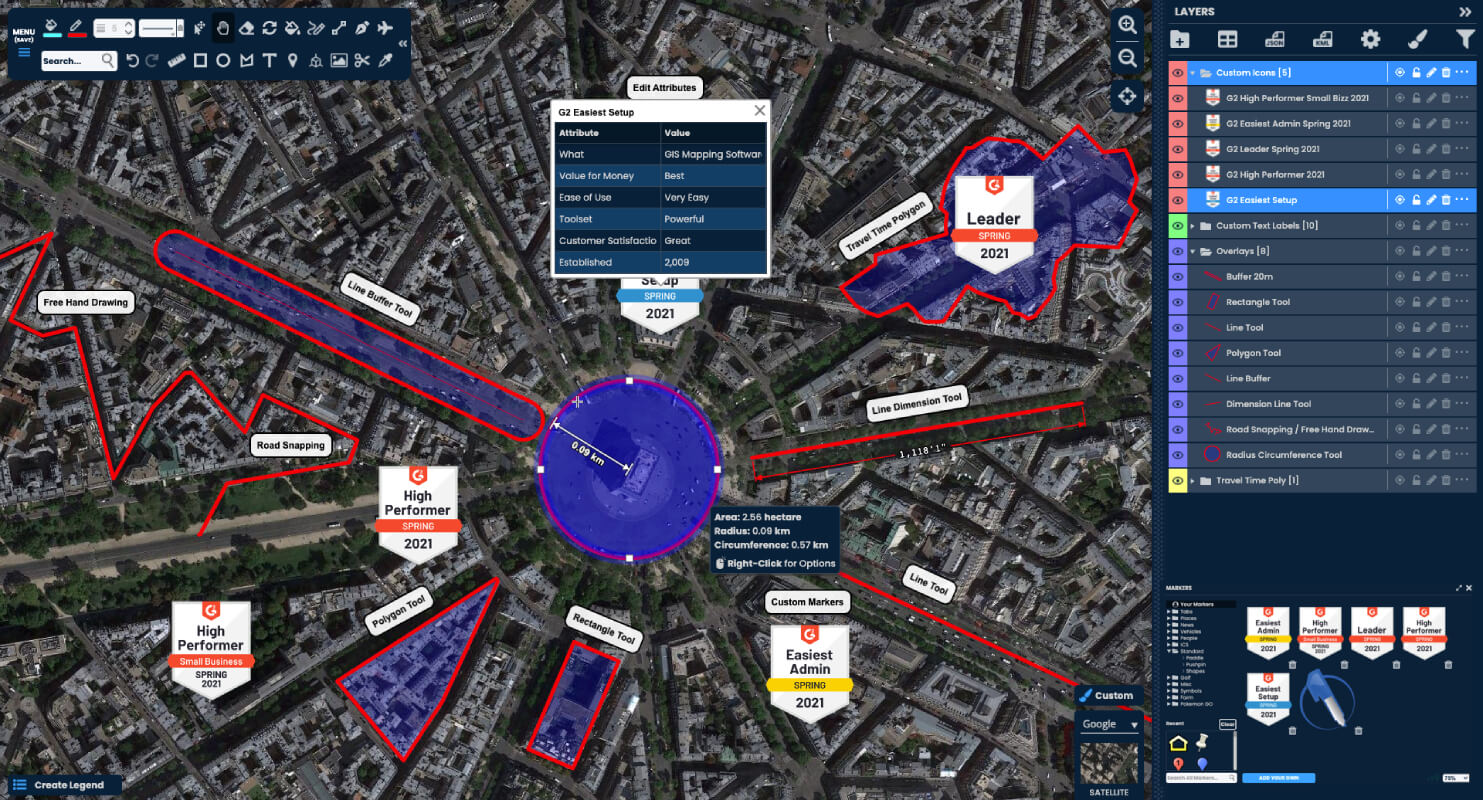
Scribble Maps is an easy-to-use online mapping platform that allows users to create, customize, and share interactive maps. It offers intuitive tools for drawing, adding markers, text, and shapes, enabling users to build personalized and detailed visualizations. The platform supports layer management, helping users organize complex maps with multiple datasets. Additionally, Scribble Maps allows users to import geospatial data from various formats, enhancing the accuracy and depth of the maps. Collaboration features enable real-time teamwork on map projects, making it ideal for businesses, research teams, and educational purposes.
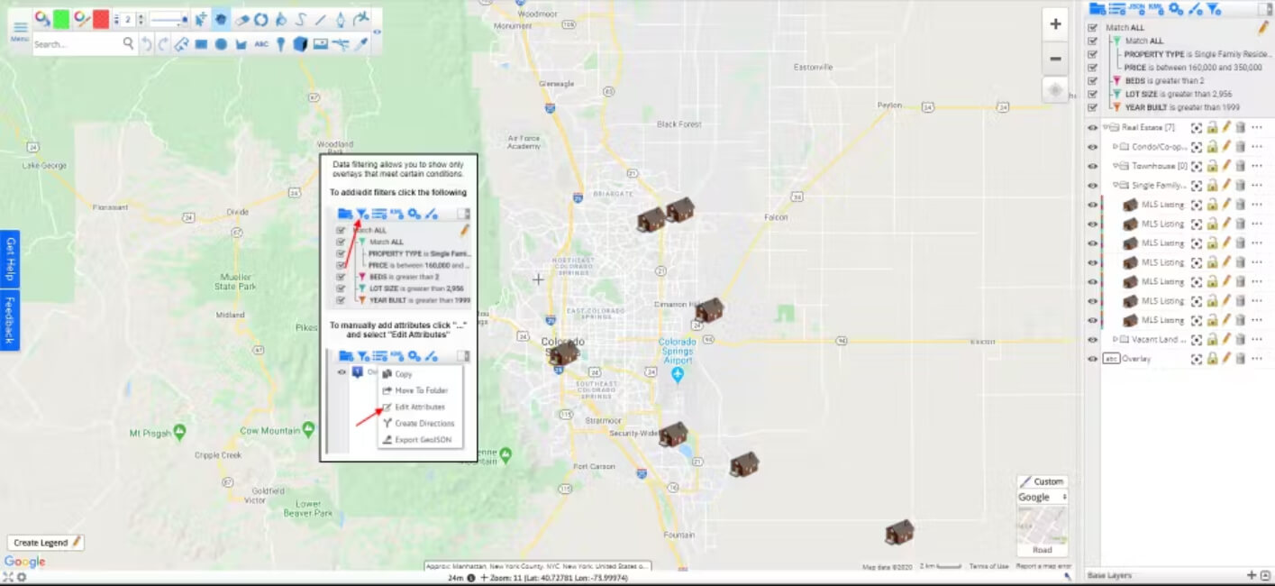
A key advantage of Scribble Maps is its user-friendly interface, which requires no technical expertise, making it accessible to a wide range of users. The platform's flexibility allows for creating maps tailored to specific needs, such as real estate analysis, infrastructure planning, or educational use. It also offers secure sharing options, including password protection and encrypted links, ensuring sensitive data remains confidential. With advanced features like attribute filtering, Scribble Maps allows users to analyze and focus on specific data points, improving overall map functionality and decision-making.