Select your language

Home arrow-right MountainsMap

We've compiled a list of 3 free and paid alternatives to MountainsMap. The primary competitors include ImageJ, OLYMPUS Stream. In addition to these, users also draw comparisons between MountainsMap and SPIP™. Also you can look at other similar options here: About.


ImageJ is a public domain, Java-based image processing program developed at the National Institutes...

OLYMPUS Stream image analysis software guides users through all the steps for image acquisition...

SPIP™ is the preferred software package for nano- and microscale image processing at high-tech...

Surface imaging, analysis and metrology software.

MountainsMap Platforms

tick-square Windows

MountainsMap Video and Screenshots

MountainsMap Overview

1. Pick the surface imaging and metrology software that matches your instrument
2. Analyze multiple types of surface data
3. Turn your surface data into accurate, visual surface analysis reports
4. See every feature with high quality real-time 3D imaging of surface topography
5. Characterize surfaces in accordance with the latest metrology standards
6. Benefit from the latest surface analysis methods and innovations
7. Exploit the most comprehensive set of surface studies
8. Co-localize surface data (topography and images) from different sources
9. Work fast in a smarter user environment with powerful automation tools
10. Benefit from the technology chosen by the leading profiler and microscope manufacturers

Top 
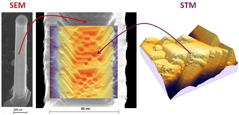
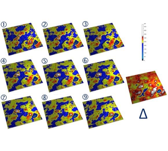
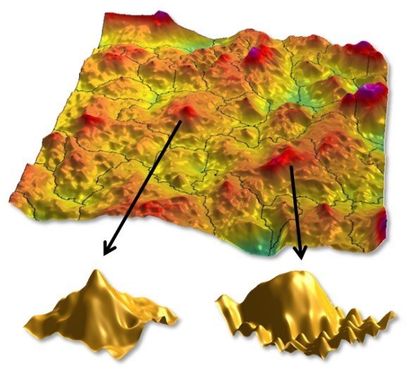
MountainsMap Alternatives

Share your opinion about the software, leave a review and help make it even better!

MountainsMap Tags

metrology surface-imaging

Suggest Changes

Your Feedback

Select a rating
Please select a rating

Your vote has been counted.

Do you have experience using this software?