TransCAD 대안
33개의 무료 및 유료 대안을 TransCAD에 대한 목록으로 정리했습니다. 주요 경쟁 업체는 PTV Visum, Aimsun Next입니다. 이 외에도 사용자들은 TransCAD와 Quadstone Paramics 간에 비교를 하기도 합니다. 또한 여기서 다른 유사한 옵션을 살펴볼 수 있습니다: About.
3개의 무료 및 유료 대안을 TransCAD에 대한 목록으로 정리했습니다. 주요 경쟁 업체는 PTV Visum, Aimsun Next입니다. 이 외에도 사용자들은 TransCAD와 Quadstone Paramics 간에 비교를 하기도 합니다. 또한 여기서 다른 유사한 옵션을 살펴볼 수 있습니다: About.
3개의 무료 및 유료 대안을 TransCAD에 대한 목록으로 정리했습니다. 주요 경쟁 업체는 PTV Visum, Aimsun Next입니다. 이 외에도 사용자들은 TransCAD와 Quadstone Paramics 간에 비교를 하기도 합니다. 또한 여기서 다른 유사한 옵션을 살펴볼 수 있습니다: About.
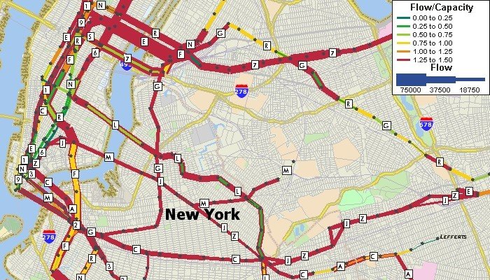
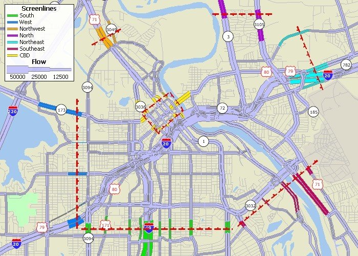
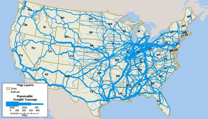
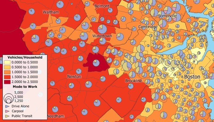
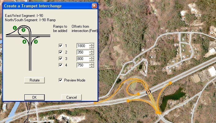
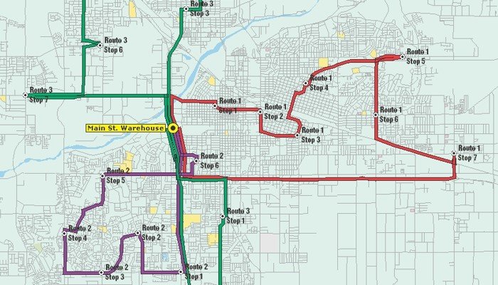
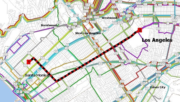
TransCAD is the first and only Geographic Information System (GIS) designed specifically for use by transportation professionals to store, display, manage, and analyze transportation data. TransCAD combines GIS and transportation modeling capabilities in a single integrated platform, providing capabilities that are unmatched by any other package. TransCAD can be used for all modes of transportation, at any scale or level of detail. TransCAD provides:
A powerful GIS engine with special extensions for transportation
Mapping, visualization, and analysis tools designed for transportation applications
Application modules for routing, travel demand forecasting, public transit, logistics, site location, and territory management
TransCAD has applications for all types of transportation data and for all modes of transportation, and is ideal for building transportation information and decision support systems. TransCAD runs on readily-available hardware under Microsoft Windows and embraces virtually all desktop computing standards. This has two important benefits:
You can acquire and install TransCAD at a much lower cost than any other integrated GIS and transportation modeling solution
You don't have to build custom applications or complicated data interchange modules to perform transportation analysis with GIS data
A Powerful GIS for Transportation
TransCAD is a state-of-the-art GIS that you can use to create and customize maps, build and maintain geographic data sets, and perform many different types of spatial analysis. TransCAD includes sophisticated GIS features such as polygon overlay, buffering, and geocoding, and has an open system architecture that supports data sharing on local- and wide-area networks.
TransCAD is the only software package that fully integrates GIS with demand modeling and logistics functionality. This makes it possible for models to be much more accurate and efficient.
소프트웨어에 대한 의견을 공유하고 리뷰를 남겨 더 나아지도록 도와주세요!
변경 제안
귀하의 의견
Your vote has been counted.
Do you have experience using this software?
