Sélectionnez votre langue

Page d'accueil arrow-right ... arrow-right Logiciels de voyage et de localisation arrow-right Hiker

Nous avons compilé une liste de 3 alternatives gratuites et payantes à Hiker. Les principaux concurrents incluent OruxMaps, MotionX GPS. En plus de cela, les utilisateurs établissent également des comparaisons entre Hiker et Outdooractive. Vous pouvez également consulter d'autres choix similaires ici : Logiciels de voyage et de localisation.


OruxMaps est une visionneuse de cartes et un enregistreur de suivi en ligne / hors ligne pour Android.

MotionX-GPS is the leading GPS App for the iPhone and iPad.

Notre vision est de faire des cartes topographiques, des suggestions de visites et d'incroyables expériences de plein air ...

La boîte à outils polyvalente pour les randonneurs, comprenant un indicateur de vitesse, une boussole et bien plus encore.

Hiker Plates-formes

tick-square iPhone

Hiker Vidéo et captures d'écran

Hiker Description

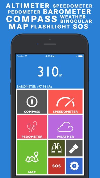
Hiker est une application polyvalente dotée de fonctionnalités telles qu'un baromètre, un altimètre, une boussole sur l'emplacement de votre satellite actuel, les mises à jour météorologiques, un compteur de vitesse et un podomètre. Utilisez des cartes et des jumelles pour le dépistage. Et lampe de poche, SOS pour les exigences.

LES FONCTIONNALITÉS INCLUENT:

ALTIMETER and BAROMETER: Get to know the latest elevation and atmospheric pressure around you using Altimeter and Barometer.
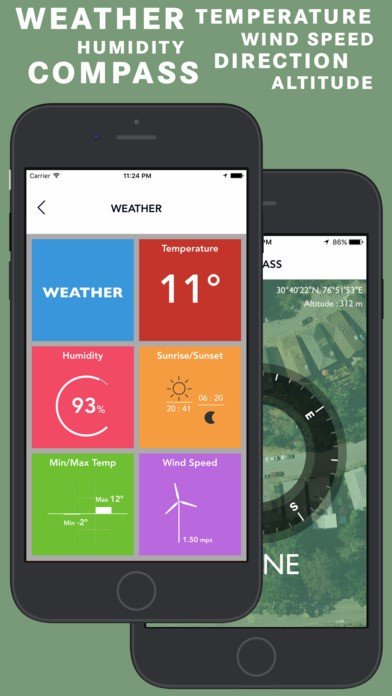
COMPASS: Compass above your satellite position always pointing according to real time direction.
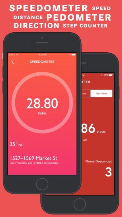
SPEEDOMETER : Speedometer to get real time speed readings along with real time direction and location address.
PEDOMETER / STEP COUNTER: Pedometer provides you the data about the steps taken and distance travelled in a specific time period along with Floors traversed.
WEATHER : Weather provides you the real time weather updates based on your location. Get Current Temperature, Humidity, Sunrise/Sunset Time, Min/Max Temperature and Wind Speed.
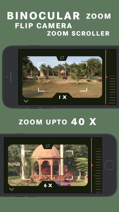
BINOCULAR : Super digital binocular app with HIGH QUALITY ZOOM upto 40X
FLASHLIGHT : Bright, optimized and reliable flashlight. The most easy to use and useful flashlight.
SOS : In problem? Message your dear ones with real time Coordinates using SOS function.
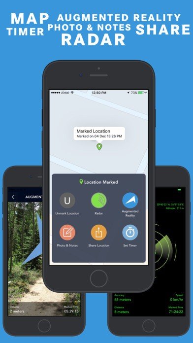
MAP : Track your position in maps with Standard/Hybrid/Satellite maps.
RADAR : Locate your marked location using RADAR
AUGMENTED REALITY: Real Time Directional ARROW point towards the direction of your marked location.
PHOTO AND NOTES: Take a picture along with written notes of your marked location and save it. So you can find your marked location even more easily.
MARKED LOCATION TIMER: Set timer alert and get push notification after timeout.
GET COORDINATES: Now you can copy your current coordinates and your marked coordinates using Get Coordinates section in “MAP SETTINGS”.
VOICE INSTRUCTIONS: Get voice instructions when you : Mark/Unmark your location.

Hiker Fonctionnalités

tick-square Pedometer

Meilleures alternatives à Hiker

Partagez votre opinion sur le logiciel, laissez un avis et contribuez à l'améliorer encore davantage !

Hiker Mots clés

hikers speedometer compass navigation

Proposer des changements

Vos commentaires

Sélectionnez une note
Veuillez sélectionner une note

Your vote has been counted.

Do you have experience using this software?