31 ücretsiz ve ücretli MyTrails alternatiflerinin bir listesini derledik. Başlıca rakipler şunları içerir: Endomondo, RunKeeper. Bunların yanı sıra, kullanıcılar MyTrails ile OruxMaps, Apple Maps, Leaflet arasında karşılaştırmalar da yaparlar. Ayrıca burada diğer benzer seçeneklere de göz atabilirsiniz: Spor ve Sağlık Yazılımı.
31 ücretsiz ve ücretli MyTrails alternatiflerinin bir listesini derledik. Başlıca rakipler şunları içerir: Endomondo, RunKeeper. Bunların yanı sıra, kullanıcılar MyTrails ile OruxMaps, Apple Maps, Leaflet arasında karşılaştırmalar da yaparlar. Ayrıca burada diğer benzer seçeneklere de göz atabilirsiniz: Spor ve Sağlık Yazılımı.
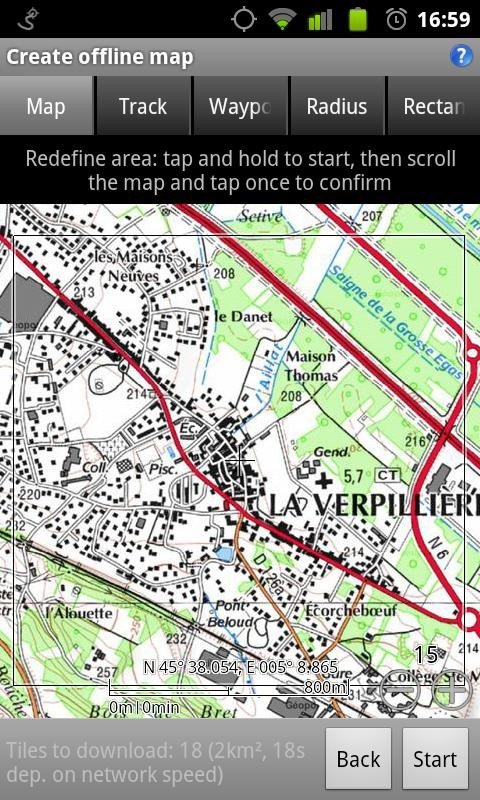
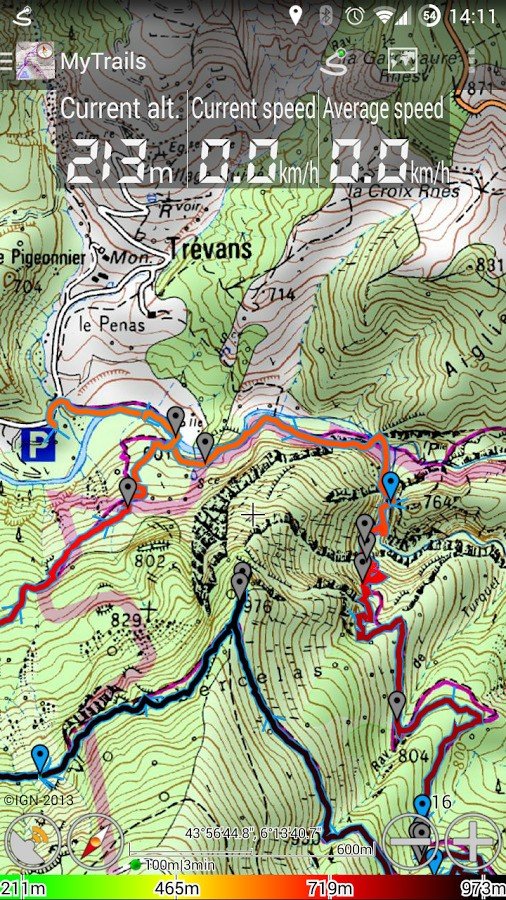
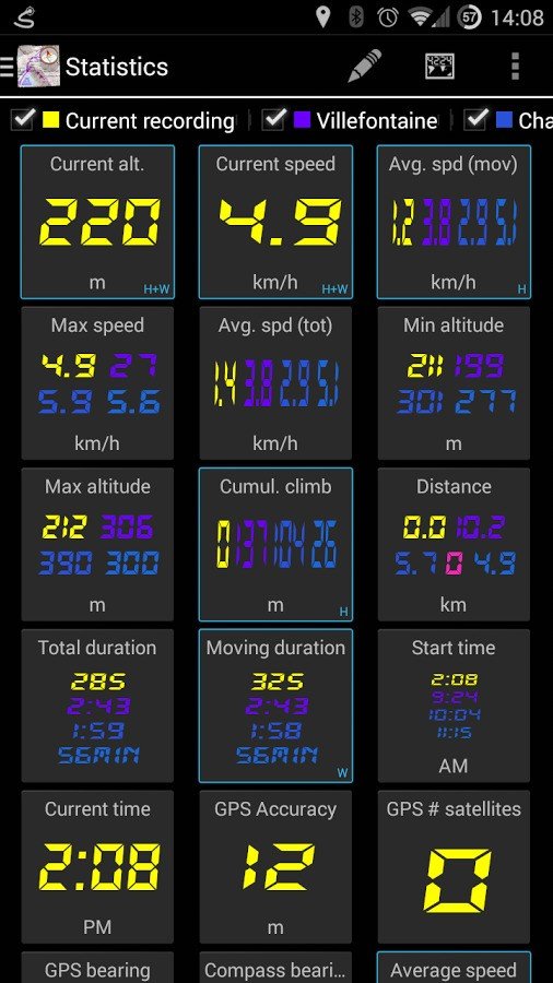
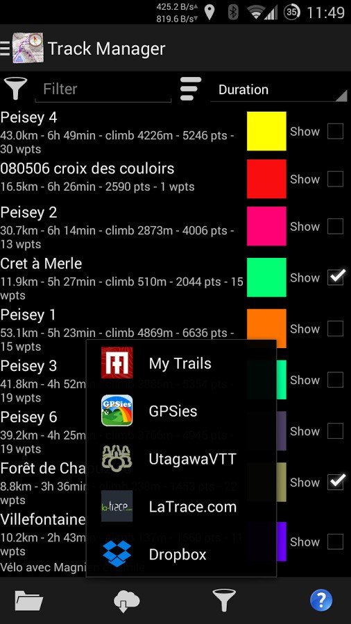
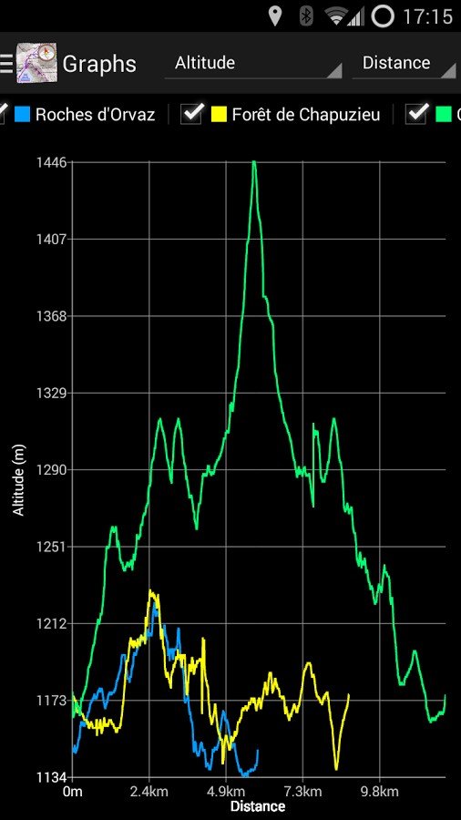
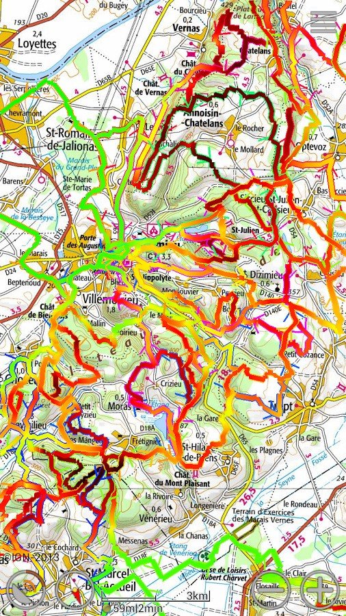
Offline trail maps for Android (and online too!) Full-screen trail map oriented with the built-in compass Know exactly which direction you are going Uncluttered map area, with unobtrusive controls and a traditional scale with track duration and distance Record GPS tracks Visualize your track at any time and analyse your course during or after the outdoor activity Display multiple GPS tracks at once Visualize your previous outings and those uploaded to GPS community sites, so you always pick a great trail Colorized tracks Visualize the key indicators of the track (altitude, speed, rate of ascent, slope, GPS accuracy) right on the map with a detailed legend OpenGL rendering Accelerated map drawing, allows smooth and snappy display even with tens of thousands of track points Kinetic scrolling, pinch zooming Have fun exploring and interacting with the map Çevrimdışı haritalar Save battery and data charges The map displays instantaneously Optionally falls back to online for non-covered areas Offline map creation No need to use desktop-based tools to create offline maps, you can do it in MyTrails, in the background Pause and resume the tile download Download on WiFi only to save data charges, or go wild Online maps Pick from many built-in online map sources (OpenStreetMap, Yahoo, Bing and many other global and local providers) Add more map sources using the editable Flexible URL provider Gestures Easily switch between active maps by swiping three fingers left to right in the map view. Pull down the HUD with information on your speed and altitude by swiping three fingers down your screen Save and load GPX files Display your previous tracks in MyTrails, geocode your pictures, use the tracks on the web or your computer MGM for offline maps Create your own MGM packs based on existing tools and efficiently store multiple zoom levels and different maps formats