Select your language

Home arrow-right ... arrow-right Travel and Location Software arrow-right GeoFlow

We've compiled a list of 16 free and paid alternatives to GeoFlow. The primary competitors include OpenStreetMap, Marble. In addition to these, users also draw comparisons between GeoFlow and Leaflet, NASA World Wind, gvSIG. Also you can look at other similar options here: Travel and Location Software.


OpenStreetMap
Free Open Source

OpenStreetMap (OSM) is a collaborative project to create a free editable map of the world.

Marble
Free Open Source

Marble is a Virtual Globe and World Atlas that you can use to learn more about Earth: You can pan...

Leaflet
Free Open Source

Leaflet is a modern open-source JavaScript library for mobile-friendly interactive maps.

NASA World Wind
Free Open Source

World Wind lets you zoom from satellite altitude into any place on Earth.

gvSIG
Free Open Source

gvSIG Mini Maps allows you to browse and navigate with GPS a full set of free on/offline maps from...

WikiMapia is a privately owned, online map and satellite imaging resource that combines Google Maps...

Modest Maps
Free Open Source

Modest Maps is a small, extensible, and free library for designers and developers who want to use...

TransforMap
Free Open Source

There are Plenty of Alternatives. TransforMap makes them visible.

Maximize the use of your Excel spreadsheet data. Make mapping the easiest.

Aciqra
Free Open Source

Aciqra (uh-SEE-kruh) is a free and open source virtual sky map and planetarium which tracks and...

GeoFlow is an add-in for GEO data visualization in Excel 2013

GeoFlow Platforms

tick-square Windows

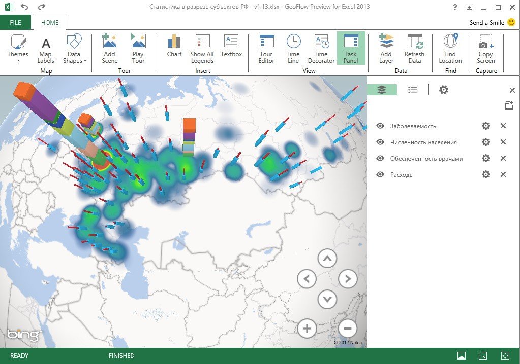
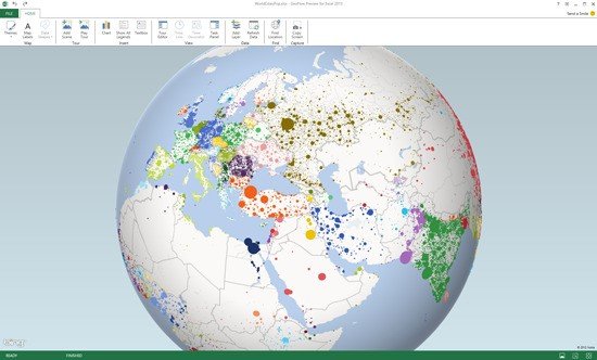
GeoFlow Video and Screenshots

GeoFlow Overview

Project codename "GeoFlow" is a tool for 2013 that provides a powerful method for people to look at information in new ways enabling discoveries in data that might never be seen in traditional 2D tables and charts. GeoFlow lets you plot visually, analyze that data in 3D, and create visual tours to share with others.

GeoFlow allows users to visually plot up to a million rows of data in 3D on Bing maps, view data in a geographic space and watch change over time, and share findings through "scenes" and cinematic, guided "tours".

GeoFlow Features

tick-square Excel Add-in
tick-square Apps with Offline Map Support

Share your opinion about the software, leave a review and help make it even better!

GeoFlow Tags

time-stamped-data temporal-data 3d-data-visualization geographic-data map-viewer excel-add-in maps data-visualization Discontinued

Suggest Changes

Your Feedback

Select a rating
Please select a rating

Your vote has been counted.

Do you have experience using this software?