Select your language

Home arrow-right ... arrow-right Travel and Location Software arrow-right ArcGIS

We've compiled a list of 69 free and paid alternatives to ArcGIS. The primary competitors include VWO Conversion Optimization Platform, GeoExpress. In addition to these, users also draw comparisons between ArcGIS and Google Maps, Badger Maps, QGIS. Also you can look at other similar options here: Travel and Location Software.


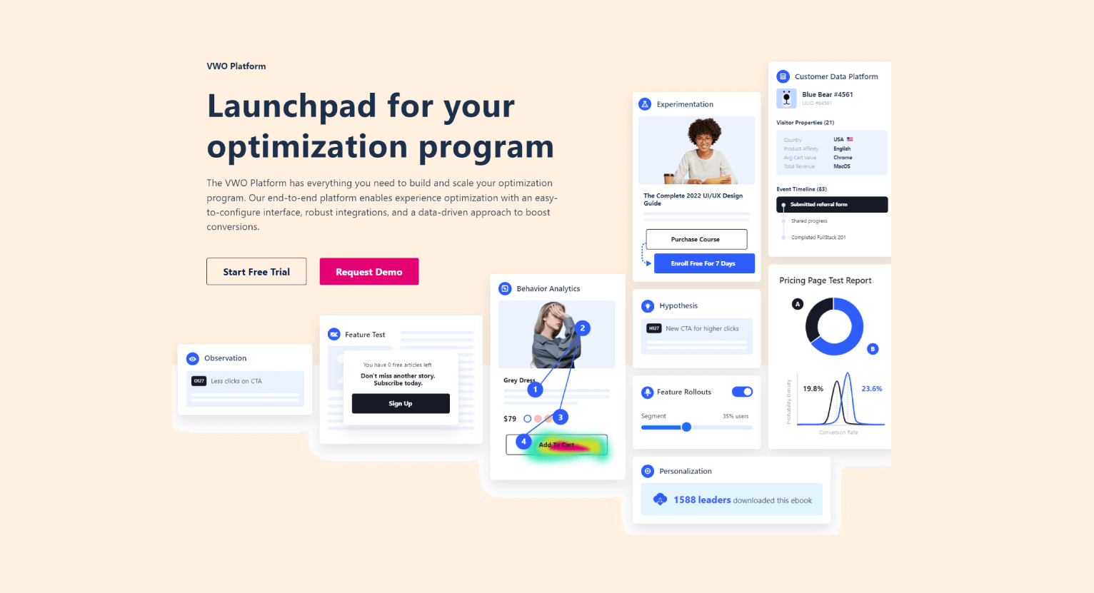
VWO is an all-in-one optimization platform that helps you enhance the entire audience journey. The VWO Platform offers a range of top-notch optimization products tailored to your audience journey and needs, providing a full suite of tools to enhance…

GeoExpress
Free Trial Subscription

Maximize GIS efficiency with GeoExpress. Convert/compress rasters to JP2, MrSID, NITF. Handle LiDAR data seamlessly. Edit images, create mosaic datasets.

Google Maps is a basic web mapping service application and technology provided by Google.

Badger Maps
Free Trial Subscription

Badger enables the sales team to manage their territory by combining Google Maps, data from the...

QGIS
Free Open Source

A fully featured, user friendly, open source Geographic Information System (GIS) with similar power...

Anaconda is the leading open data science platform powered by Python.

GRASS GIS
Free Open Source

GRASS GIS (Geographic Resources Analysis Support System) is an open source, free software (FOSS)...

Maptitude
Free Trial Subscription

Business mapping software (geographic information system) that delivers affordable, easy-to-use...

MultiRoute by gb consite GmbH is a browser based application for multiple stops route planning...

Spatial Feature Server by MapET is an ESRI Geoservices REST Implementation and works with all ESRI...

ArcGIS is geographic information system (GIS) software for visualizing, managing, creating, and...

ArcGIS Platforms

tick-square iPad
tick-square iPhone
tick-square Android
tick-square Web-Based
tick-square Windows

ArcGIS Video and Screenshots

ArcGIS Overview

ArcGIS is geographic information system (GIS) software for visualizing, managing, creating, and analyzing geographic data. Using ArcGIS, you can understand the geographic context of your data, allowing you to see relationships and identify patterns in new ways.

The ArcGIS Desktop program has 3 different lincense options: ArcView, ArcEditor and ArcInfo. ArcInfo beeing the biggest.

ArcGIS Features

tick-square Location Mapping
tick-square Interactive map
tick-square Apps with Offline Map Support
tick-square Optimized for Mobile
tick-square Built-in editor

Share your opinion about the software, leave a review and help make it even better!

ArcGIS Tags

cartography gis geographic free-storage maps mapping

Suggest Changes

Your Feedback

Select a rating
Please select a rating

Your vote has been counted.

Do you have experience using this software?